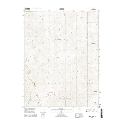
2015 Map of Carroll Summit
USGS Topo · Published 2015About this map
Desatoya Mountains dominate this high-desert landscape in central Nevada, where the drainage patterns of numerous canyons define the topography. The high point at Indian Peak overlooks a network of seasonal watercourses including Milkhouse Cr and Haypress Cr. Along the western edge, the crossing at Carroll Summit provides passage between the steep terrain of Dry Canyon and the lower reaches of Road Canyon.
Find a feature on this map
28 named features on this map. Tap any name to fly to it.
Don’t see what you’re looking for? This feature index may not catch every label — zoom into the map to look around manually.
Map Details
Editions of this 2015 Carroll Summit Map
This is the sole edition of this map. No revisions or reprints were ever made.
Other maps of this area

1955 · Millett
USGS Topo · 1:250,000

1956 · South Shoshone Peak
USGS Topo · 1:62,500

1959 · Millett
USGS Topo · 1:250,000

1969 · Cold Springs
USGS Topo · 1:24,000

1969 · Desatoya Peak
USGS Topo · 1:24,000

1969 · Carroll Summit NE
USGS Topo · 1:24,000

1969 · Carroll Summit
USGS Topo · 1:24,000

1969 · Basque Summit
USGS Topo · 1:24,000
1969 · Carroll Summit SE
USGS Topo · 1:24,000
1969 · Buffalo Summit
USGS Topo · 1:24,000