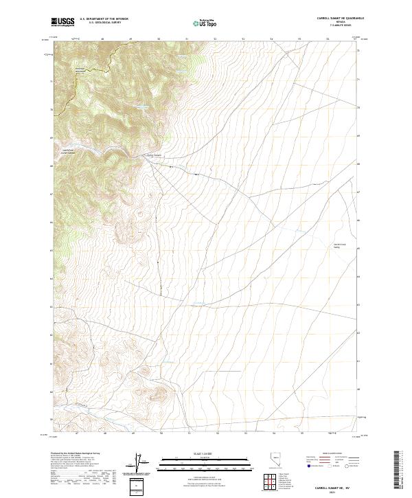
2021 Map of Carroll Summit NE
USGS Topo · Published 2021About this map
The Old Overland Rd cuts across the southern reach of this high-desert landscape, marking a corridor of historical transit through the rugged Great Basin. To the west, the Desatoya Mountains dominate the horizon, with steep drainage systems like South Fork Porter Canyon and Porter Cr flowing toward the broader Smith Creek Valley. This arid environment is defined by its vital water sources, where named springs such as Stoker Spring Number One, Corral Spring, and Twin Springs provided essential points of rest and survival for travelers and livestock. The map captures the meeting of Churchill and Lander counties along the high ridges, where the high-altitude terrain shifts from mountain peaks to the alluvial fans of the valley floor.
Find a feature on this map
17 named features on this map. Tap any name to fly to it.
Don’t see what you’re looking for? This feature index may not catch every label — zoom into the map to look around manually.
Map Details
Editions of this 2021 Carroll Summit NE Map
This is the sole edition of this map. No revisions or reprints were ever made.
Other maps of this area

1955 · Millett
USGS Topo · 1:250,000

1959 · Millett
USGS Topo · 1:250,000

1966 · Edwards Creek Valley
USGS Topo · 1:62,500

1969 · Mount Airy
USGS Topo · 1:24,000

1969 · Emigrant Peak
USGS Topo · 1:24,000

1969 · Carroll Summit NE
USGS Topo · 1:24,000

1969 · Carroll Summit
USGS Topo · 1:24,000

1969 · Basque Summit
USGS Topo · 1:24,000

1969 · Iron Mountain
USGS Topo · 1:24,000
1969 · Carroll Summit SE
USGS Topo · 1:24,000