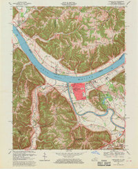
1967 Map of Carrollton
USGS Topo · Published 1970About this map
Ohio River and Kentucky River meet at the heart of this landscape, defining the development of Carrollton and Prestonville in the late 1960s. The town grid of Carrollton is densely detailed, featuring the Courthouse, City Hall, and several religious and educational landmarks such as St Johns Sch and Calvary Ch. To the east, the expansive General Butler State Park provides a recreation hub with its Campsite and Picnic Area, while the National Guard Armory sits nearby. Across the water in Indiana, the terrain of Spenter Milton and Racket Ridge is punctuated by small settlements like Brooksburg and Lamb. This survey captures the region just as modern infrastructure like Pipelines began to traverse the deep hollows and ridges of the Kentucky-Indiana border, contrasting with older sites like the Old Bethel Cem and McKay Cem.
Find a feature on this map
64 named features on this map. Tap any name to fly to it.
Don’t see what you’re looking for? This feature index may not catch every label — zoom into the map to look around manually.
Map Details
Editions of this 1967 Carrollton Map
4 editions found
Other maps of this area

1943 · Vevay North
USGS Topo · 1:24,000

1943 · Brooksburg
USGS Topo · 1:24,000

1943 · Vevay South
USGS Topo · 1:24,000

1952 · Vevay South
USGS Topo · 1:24,000

1952 · Worthville
USGS Topo · 1:24,000

1952 · Campbellsburg
USGS Topo · 1:24,000

1953 · Bedford
USGS Topo · 1:24,000

1953 · Carrollton
USGS Topo · 1:24,000

1953 · Madison East
USGS Topo · 1:24,000

1956 · Bennington
USGS Topo · 1:24,000