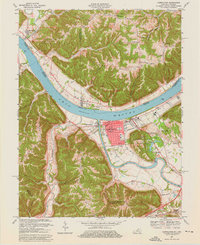
1967 Map of Carrollton
USGS Topo · Published 1976About this map
The confluence of the Ohio River and the Kentucky River dominates this 1960s-era topographic study, centering on the city of Carrollton. The urban core is detailed with civic infrastructure including the Courthouse, City Hall, and several educational institutions like the County Junior High School. Across the water, the smaller settlement of Prestonville sits at the river junction, while the expansive grounds of General Butler State Park offer a planned recreational landscape featuring a Campsite and Picnic Area. The surrounding Kentucky and Indiana hillsides reveal a network of rural life defined by family-named ridges like Wrights Ridge and numerous country churches, including Mt Zion Church and Spring Branch Church. Further south, the community of English and the curious Weather Mound highlight the diverse historical markers found in the upland terrain of Carroll and Trimble Counties.
Find a feature on this map
65 named features on this map. Tap any name to fly to it.
Don’t see what you’re looking for? This feature index may not catch every label — zoom into the map to look around manually.
Map Details
Editions of this 1967 Carrollton Map
4 editions found
Other maps of this area

1943 · Vevay North
USGS Topo · 1:24,000

1943 · Brooksburg
USGS Topo · 1:24,000

1943 · Vevay South
USGS Topo · 1:24,000

1952 · Vevay South
USGS Topo · 1:24,000

1952 · Worthville
USGS Topo · 1:24,000

1952 · Campbellsburg
USGS Topo · 1:24,000

1953 · Bedford
USGS Topo · 1:24,000

1953 · Carrollton
USGS Topo · 1:24,000

1953 · Madison East
USGS Topo · 1:24,000

1956 · Bennington
USGS Topo · 1:24,000