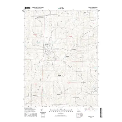
2016 Map of Carrollton
USGS Topo · Published 2016About this map
Carrollton serves as the central hub of this eastern Ohio landscape, where the confluence of several regional routes like Salineville Rd NE and Steubenville Rd SE meet. The area is characterized by a dense network of small rural settlements and distinct crossroads, including Wherrys Crossroads, Toots Crossroads, and Dutch Corners. These named intersections and tiny hamlets like Pigtown and Eckley indicate a long-standing pattern of family-farm distribution and local commerce tied to the upland terrain.
Find a feature on this map
118 named features on this map. Tap any name to fly to it.
Don’t see what you’re looking for? This feature index may not catch every label — zoom into the map to look around manually.
Map Details
Editions of this 2016 Carrollton Map
This is the sole edition of this map. No revisions or reprints were ever made.
Other maps of this area

1901 · Cadiz
USGS Topo · 1:62,500

1902 · Scio
USGS Topo · 1:62,500

1903 · Cadiz
USGS Topo · 1:62,500

1904 · Scio
USGS Topo · 1:62,500

1905 · Salineville
USGS Topo · 1:62,500

1910 · Carrollton
USGS Topo · 1:62,500

1912 · Carrollton
USGS Topo · 1:62,500

1951 · Canton
USGS Topo · 1:250,000

1953 · Canton
USGS Topo · 1:250,000

1957 · Canton
USGS Topo · 1:250,000