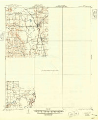
1931 Map of Carrollton
USGS Topo · Published 1949About this map
Carrollton serves as a central hub in this survey, where the convergence of the Missouri Kansas and Texas, St Louis Southwestern, and San Francisco railroads created a thriving transit point for the region. The landscape is dominated by the wandering path of the Trinity River and its Elm Fork, which shaped the early agricultural settlements and spurred the development of Trinity Mills. Outside the town centers, rural life is marked by country institutions like Bethel Church, Mount Zion Church, and several local schools, including Hackberry School and Bear Creek School. The presence of small rail stops such as Lain, Smyth, and Gribble illustrates the dense network of local shipping points that existed before the expansion of the modern Dallas-Fort Worth metroplex. Notable landmarks like the Eagle Ford Bridge and Bobos Island provide specific points of interest for those tracing family ties or property lines in the area.
Find a feature on this map
34 named features on this map. Tap any name to fly to it.
Don’t see what you’re looking for? This feature index may not catch every label — zoom into the map to look around manually.
Map Details
Editions of this 1931 Carrollton Map
3 editions found
Other maps of this area

1891 · Dallas
USGS Topo · 1:125,000

1893 · Dallas
USGS Topo · 1:125,000

1894 · Fort Worth
USGS Topo · 1:125,000

1925 · Mc Kinney 3-c
USGS Topo · 1:48,000

1925 · Dallas 2-b
USGS Topo · 1:48,000

1929 · Frisco
USGS Topo · 1:62,500

1929 · McKinney
USGS Topo · 1:62,500

1931 · Carrollton
USGS Topo · 1:62,500

1931 · Grapevine
USGS Topo · 1:62,500

1954 · Dallas
USGS Topo · 1:250,000