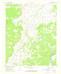
1971 Map of Carson
USGS Topo · Published 1973About this map
Carson sits at the heart of this Hughes County landscape, where the Texas and Pacific railroad cuts a diagonal line across the undulating terrain between Dustin and Barnard. The region's mid-century petroleum economy is etched into the earth through numerous Oil Wells, Drill Holes, and a central Pumping Station, showing a developed industrial footprint amidst the rural drainage basins. The Canadian River forms a major geographic boundary in the southeast corner, marking the divide where Hughes Co and Pittsburg Co meet. Waterways like Turkey Creek and Middle Creek meander through the hills, providing the natural structure for a landscape defined by its mix of resource extraction and transit infrastructure during the early 1970s.
Find a feature on this map
13 named features on this map. Tap any name to fly to it.
Don’t see what you’re looking for? This feature index may not catch every label — zoom into the map to look around manually.
Map Details
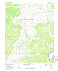
Editions of this 1971 Carson Map
2 editions found
Other maps of this area

1900 · Canadian
USGS Topo · 1:125,000

1900 · Wewoka
USGS Topo · 1:125,000

1946 · Fort Smith
USGS Topo · 1:250,000

1954 · Oklahoma City
USGS Topo · 1:250,000

1957 · Oklahoma City
USGS Topo · 1:250,000

1962 · Henryetta SW
USGS Topo · 1:24,000

1963 · Oklahoma City
USGS Topo · 1:250,000

1965 · Fort Smith
USGS Topo · 1:250,000

1967 · Fort Smith
USGS Topo · 1:250,000

1967 · Weleetka
USGS Topo · 1:24,000