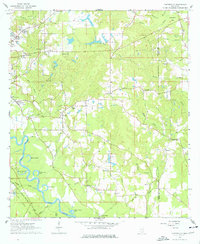
1964 Map of Carterville
USGS Topo · Published 1977About this map
The Leaf River winds through the southwestern corner of this Forrest County landscape, creating a complex system of oxbows and backwaters like Aldrich Lake, Owens Bluff Lake, and Wedgeworth Lake. This river corridor is shadowed by the Bonhomie and Hattiesburg Southern Railroad, which skirts the Hattiesburg Municipal Airport as it runs southeast toward the local timber and clay industries. Small rural communities like Carterville, Sunrise, and Pine Grove serve as anchors for the surrounding countryside, connected by a network of dirt roads and section lines.
Find a feature on this map
54 named features on this map. Tap any name to fly to it.
Don’t see what you’re looking for? This feature index may not catch every label — zoom into the map to look around manually.
Map Details
Editions of this 1964 Carterville Map
5 editions found
Other maps of this area

1947 · New Augusta
USGS Topo · 1:62,500

1949 · New Augusta
USGS Topo · 1:62,500

1953 · Hattiesburg
USGS Topo · 1:250,000

1958 · Hattiesburg
USGS Topo · 1:250,000

1963 · Barrontown
USGS Topo · 1:24,000

1964 · Carterville
USGS Topo · 1:24,000

1964 · Ovett SE
USGS Topo · 1:24,000

1964 · Ovett
USGS Topo · 1:24,000

1964 · Hattiesburg
USGS Topo · 1:24,000

1965 · Dixie
USGS Topo · 1:24,000