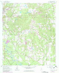
1964 Map of Carterville
USGS Topo · Published 1982About this map
The Leaf River winds through the southwestern corner of this quadrangle, defining a landscape of oxbow lakes and bottomlands including Owens Bluff Lake and Sims Lake. In the early 1960s, the growing community of Petal and the settlement of Carterville served as anchors for the local population, while the Illinois Central Gulf Railroad provided essential transit for the region's industry. The map reveals a transition from the urban edge near the Hattiesburg Municipal Airport to the rural timberlands and creek-cut hills of the Forrest and Perry county line.
Find a feature on this map
60 named features on this map. Tap any name to fly to it.
Don’t see what you’re looking for? This feature index may not catch every label — zoom into the map to look around manually.
Map Details
Editions of this 1964 Carterville Map
5 editions found
Other maps of this area

1947 · New Augusta
USGS Topo · 1:62,500

1949 · New Augusta
USGS Topo · 1:62,500

1953 · Hattiesburg
USGS Topo · 1:250,000

1958 · Hattiesburg
USGS Topo · 1:250,000

1963 · Barrontown
USGS Topo · 1:24,000

1964 · Carterville
USGS Topo · 1:24,000

1964 · Ovett SE
USGS Topo · 1:24,000

1964 · Ovett
USGS Topo · 1:24,000

1964 · Hattiesburg
USGS Topo · 1:24,000

1965 · Dixie
USGS Topo · 1:24,000