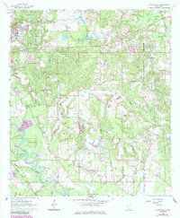
1964 Map of Carterville
USGS Topo · Published 1985About this map
Leaf River bottomlands and the emerging infrastructure of the mid-twentieth century characterize this portion of Forrest Co and Perry Co. The landscape is a network of small water bodies like Aldrich Lake and Sims Lake alongside more modern developments, including the Hattiesburg Municipal Airport and the Petal Waterworks. The eastern bank of the river shows a pattern of rural clusters and institutional landmarks, from the Sunrise Sch and Mt Vernon Ch to the Forrest Memorial Gardens. Transport is anchored by the Illinois Central Gulf Railroad and a series of rural routes connecting small settlements such as Batson and Four Points. The map records a specific era of transition, where established family-named sites like Annie Carter Lake exist alongside the expanding suburbs of Petal and Carterville.
Find a feature on this map
51 named features on this map. Tap any name to fly to it.
Don’t see what you’re looking for? This feature index may not catch every label — zoom into the map to look around manually.
Map Details
Editions of this 1964 Carterville Map
5 editions found
Other maps of this area

1947 · New Augusta
USGS Topo · 1:62,500

1949 · New Augusta
USGS Topo · 1:62,500

1953 · Hattiesburg
USGS Topo · 1:250,000

1958 · Hattiesburg
USGS Topo · 1:250,000

1963 · Barrontown
USGS Topo · 1:24,000

1964 · Carterville
USGS Topo · 1:24,000

1964 · Ovett SE
USGS Topo · 1:24,000

1964 · Ovett
USGS Topo · 1:24,000

1964 · Hattiesburg
USGS Topo · 1:24,000

1965 · Dixie
USGS Topo · 1:24,000