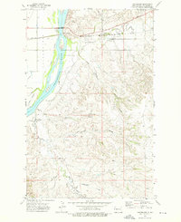
1972 Map of Cartwright
USGS Topo · Published 1976About this map
The Yellowstone River cuts through the western edge of this landscape, its path bridged by the Hjalmer Nelson Memorial Bridge as the river moves north through McKenzie County. This 1972 survey records the settlement of Cartwright and its connection to the Burlington Northern railroad, which runs parallel to Sioux Creek. The topography is dominated by a complex network of coulees, including Sheep Coulee, Sweening Coulee, and Number One Coulee, illustrating the drainage patterns into the river valley. Agricultural and local utility markers such as the Mule Creek Windmill, a Flowing Well, and a Gravel Pit are noted throughout the sections. Local recreation is centered at Sundheim Park, while named tributaries like Horse Creek and Vanderhoof Creek further define the intricate terrain of this North Dakota borderland.
Find a feature on this map
20 named features on this map. Tap any name to fly to it.
Don’t see what you’re looking for? This feature index may not catch every label — zoom into the map to look around manually.
Map Details
Editions of this 1972 Cartwright Map
This is the sole edition of this map. No revisions or reprints were ever made.
Other maps of this area

1909 · Glendive
USGS Topo · 1:250,000

1953 · Watford City
USGS Topo · 1:250,000

1954 · Glendive
USGS Topo · 1:250,000

1957 · Glendive
USGS Topo · 1:250,000

1957 · Watford City
USGS Topo · 1:250,000

1958 · Glendive
USGS Topo · 1:250,000

1966 · Sidney NE
USGS Topo · 1:24,000

1967 · Watford City
USGS Topo · 1:250,000
1968 · Buford
USGS Topo · 1:24,000
1968 · Dore
USGS Topo · 1:24,000