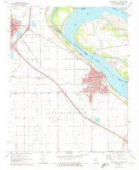
1971 Map of Caruthersville
USGS Topo · Published 1973About this map
The Mississippi River defines the landscape of this riverfront region, where the industrial and transport infrastructure of Caruthersville meets the alluvial plains of Little Prairie. This 1971 study captures a period of major infrastructure expansion, showing Interstate 55 and several connecting routes marked as Under Construction. In Hayti, the urban grid is dense with civic markers like the City Hall and Hospital, while the surrounding countryside is dotted with family and community sites like Marvin Chapel and Huffman Cem.
Find a feature on this map
47 named features on this map. Tap any name to fly to it.
Don’t see what you’re looking for? This feature index may not catch every label — zoom into the map to look around manually.
Map Details
Editions of this 1971 Caruthersville Map
3 editions found
Other maps of this area

1939 · Portageville
USGS Topo · 1:62,500

1939 · Caruthersville
USGS Topo · 1:62,500

1940 · Pascola
USGS Topo · 1:62,500

1940 · Hayti
USGS Topo · 1:62,500

1951 · Caruthersville
USGS Topo · 1:62,500

1955 · Pascola
USGS Topo · 1:62,500

1955 · Hayti
USGS Topo · 1:62,500

1955 · Portageville
USGS Topo · 1:62,500

1956 · Dyersburg
USGS Topo · 1:250,000

1957 · Caruthersville
USGS Topo · 1:62,500