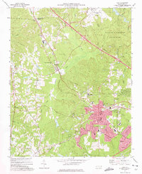
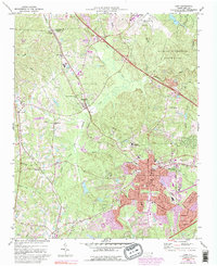
1973 Map of Cary
USGS Topo · Published 1975About this map
The town of Cary anchors this 1970s landscape, showing a period of transition as suburban footprints expand into the surrounding woodlands and farms of Wake County. Rail infrastructure remains a defining feature, with the Southern and Seaboard Coast Line railroads intersecting near the heart of the community. To the north, the Raleigh-Durham Airport and the sprawling William B Umstead State Park mark significant land use shifts at the edge of the Durham Co Wake Co line.
Find a feature on this map
45 named features on this map. Tap any name to fly to it.
Don’t see what you’re looking for? This feature index may not catch every label — zoom into the map to look around manually.
Map Details
Editions of this 1973 Cary Map
5 editions found
Other maps of this area

1943 · Durham South
USGS Topo · 1:62,500

1943 · Raleigh
USGS Topo · 1:62,500

1951 · Raleigh
USGS Topo · 1:62,500

1951 · Durham South
USGS Topo · 1:62,500

1953 · Raleigh
USGS Topo · 1:250,000

1954 · Raleigh
USGS Topo · 1:250,000

1964 · Lake Wheeler
USGS Topo · 1:24,000

1964 · Garner
USGS Topo · 1:62,500
1967 · Bayleaf
USGS Topo · 1:24,000

1968 · Raleigh West
USGS Topo · 1:24,000