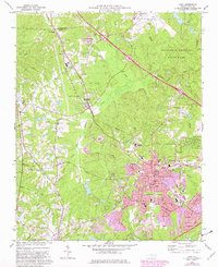
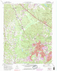
1973 Map of Cary
USGS Topo · Published 1982About this map
Cary and its surrounding townships show a period of significant suburban expansion alongside the deep-rooted rural infrastructure of Wake County. The mapping illustrates the suburban growth of the early 1970s and 1980s, with purple revision tints marking new residential developments near Northwood Sch and Briarcliff Sch. The transportation network is anchored by the Southern and Seaboard Coast Line railroads, which once serviced smaller outposts like Carpenter and Morrisville. In the northeast corner, the sprawling William B Umstead State Park preserves the natural landscape of Sycamore Creek and Reedy Creek, providing a stark contrast to the nearby industrial activity at the Raleigh-Durham Airport. Numerous community centers remain visible, including the Shiloh Ch, Goodhope Ch, and Sorrels Grove Ch, reflecting the area's social history before modern urbanization fully transformed the terrain.
Find a feature on this map
44 named features on this map. Tap any name to fly to it.
Don’t see what you’re looking for? This feature index may not catch every label — zoom into the map to look around manually.
Map Details
Editions of this 1973 Cary Map
5 editions found
Other maps of this area

1943 · Durham South
USGS Topo · 1:62,500

1943 · Raleigh
USGS Topo · 1:62,500

1951 · Raleigh
USGS Topo · 1:62,500

1951 · Durham South
USGS Topo · 1:62,500

1953 · Raleigh
USGS Topo · 1:250,000

1954 · Raleigh
USGS Topo · 1:250,000

1964 · Lake Wheeler
USGS Topo · 1:24,000

1964 · Garner
USGS Topo · 1:62,500
1967 · Bayleaf
USGS Topo · 1:24,000

1968 · Raleigh West
USGS Topo · 1:24,000