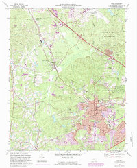
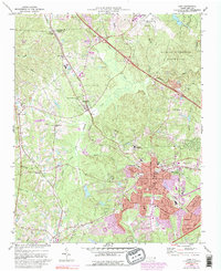
1973 Map of Cary
USGS Topo · Published 1987About this map
The town of Cary and the surrounding Wake County landscape appear in a state of rapid suburban transformation in this mid-1970s survey, with extensive revisions noted through the mid-1980s. The expansion of Research Triangle Park in the northwest corner and the proximity of the Raleigh-Durham Airport drive significant development near Clegg and Morrisville. While the burgeoning street network includes Maynard Rd and Cornwall Road, the map still preserves the older rural fabric of the region. Scattered throughout are traditional community anchors like Shiloh Ch, Goodhope Ch, and the Hill Crest Cem. The Southern and CSX railroads serve as major corridors, bisecting the landscape near Carpenter and Upchurch. Extensive purple hatching indicates areas intended for future submergence, likely related to water management along the many local branches and creeks such as Crabtree Creek.
Find a feature on this map
65 named features on this map. Tap any name to fly to it.
Don’t see what you’re looking for? This feature index may not catch every label — zoom into the map to look around manually.
Map Details
Editions of this 1973 Cary Map
5 editions found
Other maps of this area

1943 · Durham South
USGS Topo · 1:62,500

1943 · Raleigh
USGS Topo · 1:62,500

1951 · Raleigh
USGS Topo · 1:62,500

1951 · Durham South
USGS Topo · 1:62,500

1953 · Raleigh
USGS Topo · 1:250,000

1954 · Raleigh
USGS Topo · 1:250,000

1964 · Lake Wheeler
USGS Topo · 1:24,000

1964 · Garner
USGS Topo · 1:62,500
1967 · Bayleaf
USGS Topo · 1:24,000

1968 · Raleigh West
USGS Topo · 1:24,000