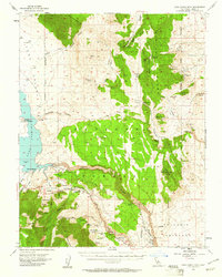
1953 Map of Casa Diablo Mtn
USGS Topo · Published 1961About this map
Crowley Lake and the Owens River dominate this 1950s landscape, where hydroelectric development meets a storied mining history. The map shows the Long Valley Dam and a Power House downstream, illustrating the era's focus on water management and energy production in the Eastern Sierra. The rugged terrain of the Benton Range and the Volcanic Tableland is dotted with numerous extraction sites, including the Casa Diablo Mine and the Kings Mill (Site). Local travel and forestry are anchored by hubs like Toms Place and the Rock Creek Guard Sta. The presence of small settlements and camps such as North Landing, South Landing, and Sherwin Ranch highlights the scattered nature of habitation in this high-altitude region before modern expansion. This survey details the complex network of springs like Moran Spring and creeks that sustain the area between the Glass Mtn Ridge and the Wheeler Crest.
Find a feature on this map
57 named features on this map. Tap any name to fly to it.
Don’t see what you’re looking for? This feature index may not catch every label — zoom into the map to look around manually.
Map Details
Editions of this 1953 Casa Diablo Mtn Map
4 editions found

Other maps of this area

1912 · Mt. Goddard
USGS Topo · 1:125,000

1913 · Bishop
USGS Topo · 1:125,000

1914 · Mt. Morrison
USGS Topo · 1:125,000

1917 · White Mountain
USGS Topo · 1:125,000

1947 · Mariposa
USGS Topo · 1:250,000

1948 · Mariposa
USGS Topo · 1:250,000

1949 · Mt. Tom
USGS Topo · 1:62,500

1949 · Bishop
USGS Topo · 1:62,500

1951 · Mt. Tom
USGS Topo · 1:62,500

1951 · Bishop
USGS Topo · 1:62,500