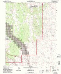
1994 Map of Casa Diablo Mtn
USGS Topo · Published 1997About this map
Casa Diablo Mtn anchors this high-desert landscape in the mid-1990s, where the eastern Sierra foothills meet the Volcanic Tableland. Industrial and water management history is etched into the terrain through a complex system of infrastructure along the Owens River Gorge, featuring Tunnel No 1, Tunnel No 2, and Tunnel No 3 feeding into a Powerhouse. The map documents the resource extraction history of the area at the Casa Diablo Mine and several scattered prospects, while also highlighting evolving conservation priorities through the designation of the Fish Slough Area of Critical Environmental Concern. Transportation history is visible in the winding path of the Old Sherwin Grade as it navigates the elevation changes near Sherwin Hill, contrasted with the straight utility of the Casa Diablo Road cutting across the Inyo National Forest.
Find a feature on this map
24 named features on this map. Tap any name to fly to it.
Don’t see what you’re looking for? This feature index may not catch every label — zoom into the map to look around manually.
Map Details
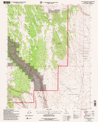
Editions of this 1994 Casa Diablo Mtn Map
2 editions found
Other maps of this area

1912 · Mt. Goddard
USGS Topo · 1:125,000

1913 · Bishop
USGS Topo · 1:125,000

1914 · Mt. Morrison
USGS Topo · 1:125,000

1917 · White Mountain
USGS Topo · 1:125,000

1947 · Mariposa
USGS Topo · 1:250,000

1948 · Mariposa
USGS Topo · 1:250,000

1949 · Mt. Tom
USGS Topo · 1:62,500

1949 · Bishop
USGS Topo · 1:62,500

1951 · Mt. Tom
USGS Topo · 1:62,500

1951 · Bishop
USGS Topo · 1:62,500