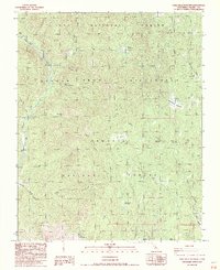
1987 Map of Casa Vieja Meadows
USGS Topo · Published 1987About this map
Jordan Hot Springs and Soda Flat mark a landscape defined by the upper Kern River drainage during the late twentieth century. This area, where the Golden Trout Wilderness meets the Inyo National Forest and Sequoia National Forest, is characterized by a high-altitude network of meadow systems and seasonal camps. The map reveals the intricate water patterns of Ninemile Creek, Osa Creek, and Fish Creek as they carve through the High Sierra terrain. Human presence is documented through a series of wilderness waypoints, from Painter Camp to the namesake Casa Vieja Meadows. Significant landmarks like Blackrock Mountain and Hockett Peak provide vertical orientation for this backcountry region, while more colorful local names like Hells Hole and Beer Keg Meadow reflect the region's historic usage by hikers and pack teams.
Find a feature on this map
35 named features on this map. Tap any name to fly to it.
Don’t see what you’re looking for? This feature index may not catch every label — zoom into the map to look around manually.
Map Details
Editions of this 1987 Casa Vieja Meadows Map
2 editions found
Other maps of this area

1905 · Olancha
USGS Topo · 1:125,000

1907 · Olancha
USGS Topo · 1:125,000

1948 · Fresno
USGS Topo · 1:250,000

1955 · Fresno
USGS Topo · 1:250,000

1956 · Fresno
USGS Topo · 1:250,000

1956 · Hockett Peak
USGS Topo · 1:62,500
1956 · Monache Mtn
USGS Topo · 1:62,500

1956 · Olancha
USGS Topo · 1:62,500
1956 · Kern Peak
USGS Topo · 1:62,500

1958 · Fresno
USGS Topo · 1:250,000