
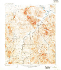
1907 Map of Casadepaga
USGS Topo · Published 1907About this map
The Council City and Solomon River Railroad winds through this interior Seward Peninsula landscape, following the course of the Casadepaga River and serving the mining interests of the early twentieth century. Surveyed by Alfred H. Brooks and his team shortly after the initial gold rush, the map reveals a remote territory organized by its waterways and fledgling infrastructure. A lone Roadhouse near the southern bend of the river indicates the essential stopovers for travelers and prospectors navigating the terrain between the coast and the inland claims.
Find a feature on this map
77 named features on this map. Tap any name to fly to it.
Don’t see what you’re looking for? This feature index may not catch every label — zoom into the map to look around manually.
Map Details
Editions of this 1907 Casadepaga Map
2 editions found
Other maps of this area

1907 · Solomon
USGS Topo · 1:62,500

1950 · Bendeleben A-6
USGS Topo · 1:63,360

1950 · Bendeleben A-4
USGS Topo · 1:63,360

1950 · Bendeleben A-5
USGS Topo · 1:63,360

1950 · Solomon C-5
USGS Topo · 1:63,360

1950 · Solomon C-6
USGS Topo · 1:63,360

1950 · Solomon C-4
USGS Topo · 1:63,360

1950 · Bendeleben
USGS Topo · 1:250,000

1950 · Solomon
USGS Topo · 1:250,000

1950 · Solomon D-6
USGS Topo · 1:63,360