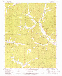
1980 Map of Cascade
USGS Topo · Published 1980About this map
Coldwater State Forest dominates the southern landscape of this Missouri Ozarks terrain, where the Cascade Lookout Tower stands as a focal point near Cascade. The geography is defined by a dense network of hollows—such as White Patch Hollow and Puch Hollow—that drain into larger watercourses like Big Creek and Twelvemile Creek. This 1980 edition captures the rural settlement patterns along the Madison and Wayne county line, where small communities like Gravelton and Twelvemile are clustered near historic spiritual centers including Zion Ch and Buckhorn Ch. The abundance of family-named cemeteries, from Huffman-McKelvey Cem to the Dixon-Sutton Cem, provides a detailed record of local genealogy within the wooded hills and creek valleys.
Find a feature on this map
60 named features on this map. Tap any name to fly to it.
Don’t see what you’re looking for? This feature index may not catch every label — zoom into the map to look around manually.
Map Details
Editions of this 1980 Cascade Map
This is the sole edition of this map. No revisions or reprints were ever made.
Other maps of this area

1930 · Coldwater
USGS Topo · 1:62,500

1933 · Marquand
USGS Topo · 1:62,500

1934 · Greenville
USGS Topo · 1:62,500

1935 · Zalma
USGS Topo · 1:62,500

1938 · Marquand
USGS Topo · 1:62,500

1939 · Greenville
USGS Topo · 1:62,500

1939 · Zalma
USGS Topo · 1:62,500

1949 · Rolla
USGS Topo · 1:250,000

1949 · Coldwater
USGS Topo · 1:62,500

1953 · Rolla
USGS Topo · 1:250,000