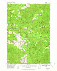
1955 Map of Cascadia
USGS Topo · Published 1963About this map
The South Santiam River and its rugged northern counterpart, the Middle Santiam River, carve deep through this portion of the Willamette National Forest in the mid-1950s. The settlement at Cascadia serves as a primary waypoint along the river, flanked by Cascadia State Park. Further east, the small community of Upper Soda sits near the riverbanks, surrounded by numerous vertical landmarks including Upper Soda Falls and Lower Soda Falls.
Find a feature on this map
71 named features on this map. Tap any name to fly to it.
Don’t see what you’re looking for? This feature index may not catch every label — zoom into the map to look around manually.
Map Details
Editions of this 1955 Cascadia Map
3 editions found
Other maps of this area

1929 · Mill City
USGS Topo · 1:125,000

1934 · Mc Kenzie Bridge
USGS Topo · 1:96,000

1940 · Mc Kenzie Bridge
USGS Topo · 1:125,000

1951 · Sweet Home
USGS Topo · 1:62,500

1951 · Leaburg
USGS Topo · 1:62,500

1951 · Snow Peak
USGS Topo · 1:62,500

1953 · Salem
USGS Topo · 1:250,000

1954 · Salem
USGS Topo · 1:250,000

1955 · Blue River
USGS Topo · 1:62,500

1955 · Cascadia
USGS Topo · 1:62,500