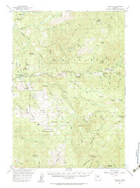
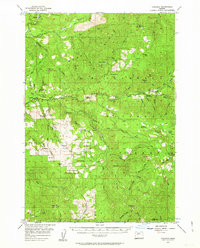
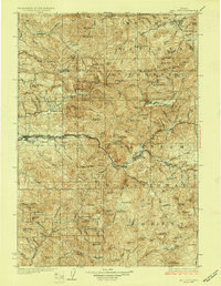
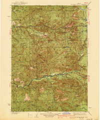
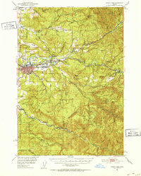
1955 Map of Cascadia
USGS Topo · Published 1984About this map
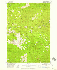
The South Santiam River and its northern tributary, the Middle Santiam River, define the topographical character of this mid-1950s survey. The small settlement of Cascadia sits at the edge of Cascadia State Park, serving as a gateway to the dense timberlands of the Willamette National Forest. To the north, the historic mining area around Quartzville is documented, while the central portion of the map is dominated by the steep elevation of Moose Ridge and Moose Mountain. Fire lookouts and lookout points are strategically positioned at high elevations such as High Deck, Rooster Rock, and Twin Buttes. The mapping also identifies recreational and forestry infrastructure, including Trout Creek Forest Camp and Fernview Forest Camp, alongside distinctive natural features like Moose Lake and the high marshy ground of Gordon Meadows.
Find a feature on this map
68 named features on this map. Tap any name to fly to it.
Don’t see what you’re looking for? This feature index may not catch every label — zoom into the map to look around manually.
Map Details
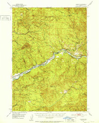
Editions of this 1955 Cascadia Map
3 editions found
Other maps of this area
1929 · Mill City
USGS Topo · 1:125,000

1934 · Mc Kenzie Bridge
USGS Topo · 1:96,000
1940 · Mc Kenzie Bridge
USGS Topo · 1:125,000
1951 · Sweet Home
USGS Topo · 1:62,500
1951 · Leaburg
USGS Topo · 1:62,500
1951 · Snow Peak
USGS Topo · 1:62,500

1953 · Salem
USGS Topo · 1:250,000

1954 · Salem
USGS Topo · 1:250,000
1955 · Blue River
USGS Topo · 1:62,500
1955 · Cascadia
USGS Topo · 1:62,500