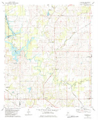
1980 Map of Casemore
USGS Topo · Published 1984About this map
Black Warrior-Demopolis Lake River dominates the western edge of this landscape where the borders of Hale, Greene, and Marengo counties converge. The terrain is defined by the winding paths of Big Prairie Creek and German Creek, which drain a region of small settlements and rural gathering places. Community life in the late 20th century centered around locations like Cedarville, Oak Grove, and the Cedarville Community Hall, while several country churches including Mars Hill Ch and St Andrews Ch point to the area's deep-rooted social fabric.
Find a feature on this map
31 named features on this map. Tap any name to fly to it.
Don’t see what you’re looking for? This feature index may not catch every label — zoom into the map to look around manually.
Map Details
Editions of this 1980 Casemore Map
4 editions found
Other maps of this area

1946 · Demopolis
USGS Topo · 1:24,000

1947 · Demopolis
USGS Topo · 1:24,000

1947 · Mason Bend
USGS Topo · 1:24,000

1948 · Mason Bend
USGS Topo · 1:24,000

1953 · Montgomery
USGS Topo · 1:250,000

1956 · Montgomery
USGS Topo · 1:250,000

1957 · Montgomery
USGS Topo · 1:250,000

1968 · Uniontown West
USGS Topo · 1:24,000

1968 · Gallion
USGS Topo · 1:24,000

1970 · Old Spring Hill
USGS Topo · 1:24,000