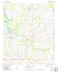
1980 Map of Casemore
USGS Topo · Published 1986About this map
The Black Warrior River and the expansive Demopolis Lake dominate this landscape on the border of Hale and Marengo counties. In the mid-1970s and early 1980s, the river system remained central to the region's geography, marked by engineering landmarks like Lock 5 and the remnants of Old Lock No. 5. The interior is characterized by a dense network of watercourses including Big Prairie Creek and German Creek, which drain the agricultural land around Cedarville and Prairieville.
Find a feature on this map
36 named features on this map. Tap any name to fly to it.
Don’t see what you’re looking for? This feature index may not catch every label — zoom into the map to look around manually.
Map Details
Editions of this 1980 Casemore Map
4 editions found
Other maps of this area

1946 · Demopolis
USGS Topo · 1:24,000

1947 · Demopolis
USGS Topo · 1:24,000

1947 · Mason Bend
USGS Topo · 1:24,000

1948 · Mason Bend
USGS Topo · 1:24,000

1953 · Montgomery
USGS Topo · 1:250,000

1956 · Montgomery
USGS Topo · 1:250,000

1957 · Montgomery
USGS Topo · 1:250,000

1968 · Uniontown West
USGS Topo · 1:24,000

1968 · Gallion
USGS Topo · 1:24,000

1970 · Old Spring Hill
USGS Topo · 1:24,000