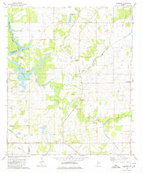
1980 Map of Casemore
USGS Topo · Published 1980About this map
The Black Warrior River Demopolis Lake marks the western edge of this landscape, where Lock 5 and numerous boat ramps indicate the importance of the river for navigation and recreation. To the east, the topography transitions into the fertile soils of the Black Belt, characterized by a high density of small rural communities and churches. Settlements such as Cedarville, Casemore, and Prairieville are interconnected by a network of roads, including the Southern rail line running across the southern portion of the quadrangle.
Find a feature on this map
31 named features on this map. Tap any name to fly to it.
Don’t see what you’re looking for? This feature index may not catch every label — zoom into the map to look around manually.
Map Details
Editions of this 1980 Casemore Map
4 editions found
Other maps of this area

1946 · Demopolis
USGS Topo · 1:24,000

1947 · Demopolis
USGS Topo · 1:24,000

1947 · Mason Bend
USGS Topo · 1:24,000

1948 · Mason Bend
USGS Topo · 1:24,000

1953 · Montgomery
USGS Topo · 1:250,000

1956 · Montgomery
USGS Topo · 1:250,000

1957 · Montgomery
USGS Topo · 1:250,000

1968 · Uniontown West
USGS Topo · 1:24,000

1968 · Gallion
USGS Topo · 1:24,000

1970 · Old Spring Hill
USGS Topo · 1:24,000