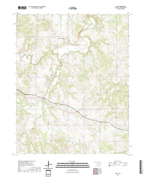
2022 Map of Casey
USGS Topo · Published 2022About this map
Skedee Cem and Valley Cem stand as quiet landmarks within this rural Oklahoma landscape in Pawnee County. The terrain is defined by a dense network of watercourses, including the winding Black Bear Creek and its tributaries like Camp Creek and Hellroaring Cr. Smaller settlements such as Cody, Esau Junction, and Casey are linked by a grid of section-line roads, such as n3530 RD and e0480 RD, reflecting the organized land division of the region. Engineered water management is evident through features like the Lower Black Bear Cr Site 27 Reservoir and Lower Black Bear Cr Site 24 Reservoir. This survey captures a modern view of the agricultural and ranching infrastructure that has sustained these communities for decades, providing a clear record of family-named roads and established cemetery sites essential for genealogical research.
Find a feature on this map
34 named features on this map. Tap any name to fly to it.
Don’t see what you’re looking for? This feature index may not catch every label — zoom into the map to look around manually.
Map Details
Editions of this 2022 Casey Map
This is the sole edition of this map. No revisions or reprints were ever made.
Other maps of this area

1929 · Yale
USGS Topo · 1:62,500

1929 · Ripley
USGS Topo · 1:62,500

1929 · Skedee
USGS Topo · 1:62,500

1930 · Pawnee
USGS Topo · 1:62,500

1931 · Skedee
USGS Topo · 1:62,500

1932 · Yale
USGS Topo · 1:62,500

1932 · Ripley
USGS Topo · 1:62,500

1936 · Pawnee
USGS Topo · 1:62,500

1955 · Enid
USGS Topo · 1:250,000

1958 · Enid
USGS Topo · 1:250,000