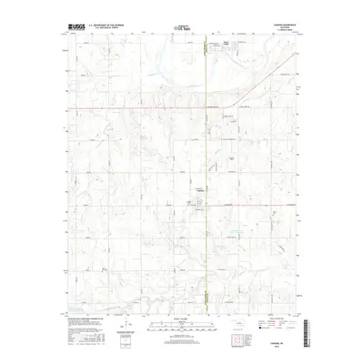
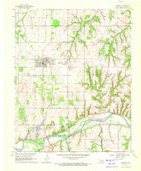
2016 Map of Cashion
USGS Topo · Published 2016About this map
Cashion straddles the county line between Kingfisher and Logan, serving as a hub for the surrounding agricultural plains. This survey documents the town's layout and the rural landscape defined by an extensive creek network, including Walnut Cr, Campbell Cr, and Pawnee Cr as they feed toward the Cimarron River. The area's history is reflected in its scattered burial grounds, such as Cashion Cem, Mercy Cem, and Mount Zion Cem, which provide essential points of reference for local genealogists. In addition to traditional farming tracts, the landscape features modern hydrological management with several reservoirs, including Cottonwood Cr Site 11 Reservoir and Cottonwood Cr Site 12 Reservoir. The community of Twin Lakes and local landmarks like Lockhart Field underscore the small-town character of this Oklahoma prairie region.
Find a feature on this map
42 named features on this map. Tap any name to fly to it.
Don’t see what you’re looking for? This feature index may not catch every label — zoom into the map to look around manually.
Map Details
Editions of this 2016 Cashion Map
This is the sole edition of this map. No revisions or reprints were ever made.
Other maps of this area

1892 · Kingfisher
USGS Topo · 1:125,000

1895 · Kingfisher
USGS Topo · 1:125,000

1954 · Oklahoma City
USGS Topo · 1:250,000

1957 · Oklahoma City
USGS Topo · 1:250,000

1963 · Oklahoma City
USGS Topo · 1:250,000
1966 · Bethany NE
USGS Topo · 1:24,000

1966 · Piedmont
USGS Topo · 1:24,000
1969 · Crescent NW
USGS Topo · 1:24,000
1970 · Navina
USGS Topo · 1:24,000
1970 · Crescent
USGS Topo · 1:24,000