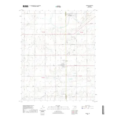
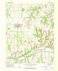
2018 Map of Cashion
USGS Topo · Published 2018About this map
The town of Cashion sits at the intersection of Kingfisher and Logan counties, where the high plains meet the drainage networks of the Cimarron River. This 2018 survey reveals a landscape of modern rural development defined by an extensive grid of section-line roads such as Co Line Rd and W Prairie Grove Rd. The area is notably shaped by water management, featuring numerous named catchments like the Cottonwood Cr Site 11 Reservoir and 07304 Reservoir. Local history is anchored by long-standing landmarks, including Lockhart Field and several community burial grounds such as Cashion Cem and Mercy Cem. To the north, the shifting channels of the Cimarron River and its accompanying Twin Lakes contrast with the rectilinear agricultural plots that dominate the southern reaches of the quadrangle along Cottonwood Cr.
Find a feature on this map
69 named features on this map. Tap any name to fly to it.
Don’t see what you’re looking for? This feature index may not catch every label — zoom into the map to look around manually.
Map Details
Editions of this 2018 Cashion Map
This is the sole edition of this map. No revisions or reprints were ever made.
Other maps of this area

1892 · Kingfisher
USGS Topo · 1:125,000

1895 · Kingfisher
USGS Topo · 1:125,000

1954 · Oklahoma City
USGS Topo · 1:250,000

1957 · Oklahoma City
USGS Topo · 1:250,000

1963 · Oklahoma City
USGS Topo · 1:250,000
1966 · Bethany NE
USGS Topo · 1:24,000

1966 · Piedmont
USGS Topo · 1:24,000
1969 · Crescent NW
USGS Topo · 1:24,000
1970 · Navina
USGS Topo · 1:24,000
1970 · Crescent
USGS Topo · 1:24,000