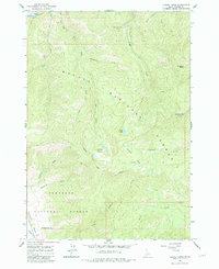
1963 Map of Casino Lakes
USGS Topo · Published 1984About this map
The Salmon River cuts through the northern reach of this high-elevation terrain, where the Challis National Forest and Sawtooth National Forest converge. This 1963 field-checked study documents a landscape defined by its drainages, where Big Casino Creek and Little Casino Creek flow northward toward the river corridor. High alpine basins hold the Casino Lakes, Garland Lakes, and Rough Lake, providing a clear look at the hydrologic patterns of the central Idaho mountains before later recreational developments.
Find a feature on this map
26 named features on this map. Tap any name to fly to it.
Don’t see what you’re looking for? This feature index may not catch every label — zoom into the map to look around manually.
Map Details
Editions of this 1963 Casino Lakes Map
4 editions found
Other maps of this area

1919 · Custer
USGS Topo · 1:125,000

1922 · Custer
USGS Topo · 1:125,000

1957 · Challis
USGS Topo · 1:250,000

1960 · Challis
USGS Topo · 1:250,000

1963 · Challis
USGS Topo · 1:250,000

1963 · Mt Cramer
USGS Topo · 1:24,000

1963 · Stanley
USGS Topo · 1:24,000

1963 · Basin Butte
USGS Topo · 1:24,000

1963 · Casino Lakes
USGS Topo · 1:24,000
1963 · Obsidian
USGS Topo · 1:24,000