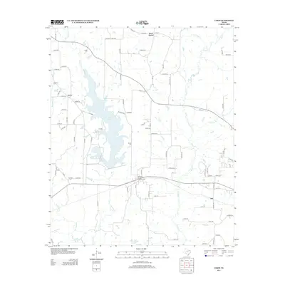
2013 Map of Cason
USGS Topo · Published 2013About this map
Welsh Reservoir dominates the central landscape of this East Texas study, its irregular fingers reaching into the surrounding timber and pastureland north of Cason. The 2013 data illustrates a rural infrastructure defined by scattered family settlements and a significant concentration of local burial sites, including Justiss Cem, Snodgrass Cem, and Lev Olds Cem. These markers, along with the settlement at Roeder, provide essential geographic anchors for genealogical research in Titus County. The drainage network is clearly defined by Swauano Cr and Boggy Cr, which feed toward Big Cypress Cr at the southern boundary. Rising above the low-lying creek bottoms, Mount Mitchell stands as a prominent local landmark in the northern portion of the quadrangle.
Find a feature on this map
86 named features on this map. Tap any name to fly to it.
Don’t see what you’re looking for? This feature index may not catch every label — zoom into the map to look around manually.
Map Details
Editions of this 2013 Cason Map
This is the sole edition of this map. No revisions or reprints were ever made.
Other maps of this area

1914 · Daingerfield
USGS Topo · 1:62,500

1953 · Texarkana
USGS Topo · 1:250,000

1956 · Texarkana
USGS Topo · 1:250,000

1956 · Tyler
USGS Topo · 1:250,000

1960 · La Fayette
USGS Topo · 1:24,000

1960 · Pittsburg
USGS Topo · 1:24,000

1962 · Lone Star
USGS Topo · 1:24,000

1964 · Harvard
USGS Topo · 1:24,000

1964 · Daingerfield
USGS Topo · 1:24,000

1964 · Cason
USGS Topo · 1:24,000