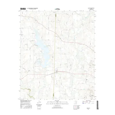
2016 Map of Cason
USGS Topo · Published 2016About this map
Cason sits at the intersection of several local routes in this East Texas landscape, serving as a focal point between the Titus and Morris County line. The western portion of the area is dominated by the sprawling Welsh Reservoir, which gathers waters from Swauano Cr and Williamson Cr. This reservoir's presence reshaped the local drainage and access, creating a complex shoreline that borders several long-established family sites.
Find a feature on this map
64 named features on this map. Tap any name to fly to it.
Don’t see what you’re looking for? This feature index may not catch every label — zoom into the map to look around manually.
Map Details
Editions of this 2016 Cason Map
This is the sole edition of this map. No revisions or reprints were ever made.
Other maps of this area

1914 · Daingerfield
USGS Topo · 1:62,500

1953 · Texarkana
USGS Topo · 1:250,000

1956 · Texarkana
USGS Topo · 1:250,000

1956 · Tyler
USGS Topo · 1:250,000

1960 · La Fayette
USGS Topo · 1:24,000

1960 · Pittsburg
USGS Topo · 1:24,000

1962 · Lone Star
USGS Topo · 1:24,000

1964 · Harvard
USGS Topo · 1:24,000

1964 · Daingerfield
USGS Topo · 1:24,000

1964 · Cason
USGS Topo · 1:24,000