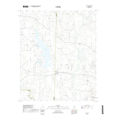
2019 Map of Cason
USGS Topo · Published 2019About this map
The Welsh Reservoir serves as a central hydrological feature for this portion of East Texas, where the borders of Titus, Morris, and Camp counties converge. The small settlement of Cason sits just east of the reservoir, positioned along a network of country roads including FM 144 and Snow Hill Rd. This landscape is particularly rich for family historians, as it preserves the locations of several community burial grounds, such as Justiss Cem, Snodgrass Cem, and Lev Olds Cem. Further south, near the Black Mountains, the terrain transitions toward the drainage basins of Swauano Cr and Boggy Cr. The map also identifies the locality of Gillis, providing a spatial record of small rural centers and the winding creek systems like Whitmore Br and Okry Cr that have shaped the region's agricultural and social patterns for generations.
Find a feature on this map
77 named features on this map. Tap any name to fly to it.
Don’t see what you’re looking for? This feature index may not catch every label — zoom into the map to look around manually.
Map Details
Editions of this 2019 Cason Map
This is the sole edition of this map. No revisions or reprints were ever made.
Other maps of this area

1914 · Daingerfield
USGS Topo · 1:62,500

1953 · Texarkana
USGS Topo · 1:250,000

1956 · Texarkana
USGS Topo · 1:250,000

1956 · Tyler
USGS Topo · 1:250,000

1960 · La Fayette
USGS Topo · 1:24,000

1960 · Pittsburg
USGS Topo · 1:24,000

1962 · Lone Star
USGS Topo · 1:24,000

1964 · Harvard
USGS Topo · 1:24,000

1964 · Daingerfield
USGS Topo · 1:24,000

1964 · Cason
USGS Topo · 1:24,000