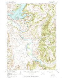
1961 Map of Cassa
USGS Topo · Published 1985About this map
The North Platte River carves a winding path through this Wyoming landscape, defining the character of the region as it transitions into the expansive Glendo Reservoir. Completed just a few years prior to this survey's field check, the Glendo Dam and its associated spillway have transformed the river valley into a significant water management and recreation hub, now known as Glendo State Park. This development sits in contrast to the deep-rooted historical paths that cross the terrain, most notably the Emigrant Trail, which traces the movements of early western travelers along the southern reaches of the river near Bulls Bend.
Find a feature on this map
35 named features on this map. Tap any name to fly to it.
Don’t see what you’re looking for? This feature index may not catch every label — zoom into the map to look around manually.
Map Details
Editions of this 1961 Cassa Map
3 editions found
Other maps of this area

1896 · Hartville
USGS Topo · 1:125,000

1901 · Hartville
USGS Topo · 1:125,000

1949 · Cedar Top
USGS Topo · 1:24,000

1950 · Glendo
USGS Topo · 1:24,000

1950 · Cedar Top
USGS Topo · 1:24,000

1950 · Jewel Springs
USGS Topo · 1:24,000

1950 · Coleman Butte
USGS Topo · 1:24,000

1950 · Herman Ranch
USGS Topo · 1:24,000

1950 · Haushar Ranch
USGS Topo · 1:24,000

1950 · Guernsey Reservoir
USGS Topo · 1:24,000