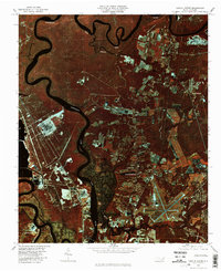
1980 Map of Castle Hayne
USGS Topo · Published 1985About this map
The Northeast Cape Fear River dominates this coastal landscape, winding through a complex network of wetlands and industrial corridors north of Wilmington. Unlike traditional topographic maps, this color infrared orthophotograph, captured in late 1980, provides a literal view of the land use patterns during a period of significant regional growth. The bright signatures of industrial sites and residential developments in Wrightsboro and Castle Hayne contrast sharply with the dark, reflective waters and the deep red of the surrounding forest and swamp vegetation.
Find a feature on this map
10 named features on this map. Tap any name to fly to it.
Don’t see what you’re looking for? This feature index may not catch every label — zoom into the map to look around manually.
Map Details
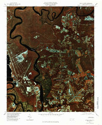
Editions of this 1980 Castle Hayne Map
2 editions found
Other maps of this area

1942 · Wilmington
USGS Topo · 1:62,500

1943 · Winnabow
USGS Topo · 1:24,000

1944 · Winnabow
USGS Topo · 1:31,680

1947 · Rocky Point
USGS Topo · 1:62,500

1948 · Wilmington
USGS Topo · 1:62,500

1950 · Winnabow
USGS Topo · 1:25,000

1953 · Florence
USGS Topo · 1:250,000

1953 · Beaufort
USGS Topo · 1:250,000

1954 · Florence
USGS Topo · 1:250,000

1954 · Beaufort
USGS Topo · 1:250,000