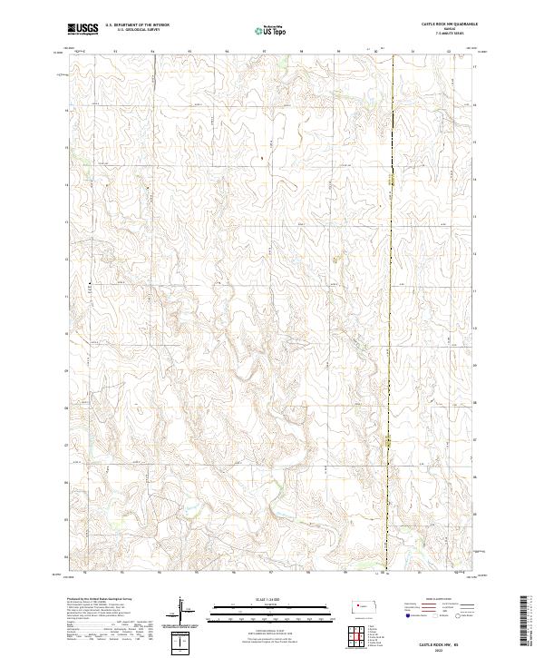
2022 Map of Castle Rock NW
USGS Topo · Published 2022About this map
The High Plains landscape of Western Kansas is defined here by the winding course of Hackberry Cr, which carves through the undulating terrain of Gove and Trego counties. This 2022 survey documents a sparsely settled agricultural region where the section line road network, including routes like Gove R and Gove U, organizes the vast open spaces. A notable point of local history is the Red Top Cem, situated in the northwest quadrant near the intersection of Gove R and Gove 72. The boundary between Gove and Trego counties runs north-to-south along the eastern edge of the map, illustrating the precise rectangular survey system that governs this part of the state. The hydrology is dominated by seasonal drainage patterns feeding into the creek, reflecting the arid character of the Kansas shortgrass prairie.
Find a feature on this map
23 named features on this map. Tap any name to fly to it.
Don’t see what you’re looking for? This feature index may not catch every label — zoom into the map to look around manually.
Map Details
Editions of this 2022 Castle Rock NW Map
This is the sole edition of this map. No revisions or reprints were ever made.
Other maps of this area

1954 · Goodland
USGS Topo · 1:250,000

1955 · Scott City
USGS Topo · 1:250,000

1956 · Goodland
USGS Topo · 1:250,000

1957 · Goodland
USGS Topo · 1:250,000

1958 · Scott City
USGS Topo · 1:250,000

1972 · Gove NE
USGS Topo · 1:24,000

1972 · Castle Rock NW
USGS Topo · 1:24,000
1972 · Castle Rock NE
USGS Topo · 1:24,000

1974 · Gove SE
USGS Topo · 1:24,000

1974 · Castle Rock
USGS Topo · 1:24,000