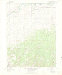
1966 Map of Castor Gulch
USGS Topo · Published 1969About this map
The Yampa River and its broad alluvial basin at Big Bottom dominate the northern landscape of this Moffat County region, just south of the Craig corporate boundary. This mid-century survey captures a transition from the industrial activity near the Municipal Airport to the high, broken terrain of the Williams Fork Mountains. Evidence of the local extraction economy is visible throughout, from the Walker Mine in the east to numerous scattered oil wells and drill holes dotting the ridges. The small settlement of Hamilton serves as a southern anchor near the Hamilton Sch, situated where the landscape begins its steep ascent into the mountains. Between the river and the peaks, a complex network of drainages including Castor Gulch, Pyeatt Gulch, and Deacon Gulch defines the geography, while labels like Thompson Hill and Bogenschutz Creek suggest the area's pioneer and ranching history.
Find a feature on this map
33 named features on this map. Tap any name to fly to it.
Don’t see what you’re looking for? This feature index may not catch every label — zoom into the map to look around manually.
Map Details
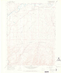
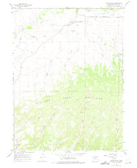
Editions of this 1966 Castor Gulch Map
3 editions found
Other maps of this area

1910 · Danforth Hills
USGS Topo · 1:125,000

1915 · Monument Butte
USGS Topo · 1:62,500

1916 · Craig
USGS Topo · 1:125,000

1916 · Daton Peak
USGS Topo · 1:62,500

1920 · Daton Peak
USGS Topo · 1:62,500

1923 · Elkhead Creek
USGS Topo · 1:62,500

1924 · Elkhead Creek
USGS Topo · 1:62,500

1954 · Craig
USGS Topo · 1:250,000

1957 · Craig
USGS Topo · 1:250,000

1958 · Craig
USGS Topo · 1:250,000