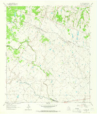
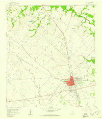
1963 Map of Cat Spring
USGS Topo · Published 1966About this map
Cat Spring serves as the focal point of this 1960s study, situated at the intersection of local history and commerce in eastern Texas. The town is tied to the regional rail network by the Missouri Kansas Texas railroad, which cuts across the landscape near several gravel extraction sites. The terrain is defined by the winding course of the San Bernard River and the Little Bernard Creek, which carve through the undulating land near the Austin Co Colorado Co boundary. Genealogists and local historians will find significant value in the documentation of family and community burial grounds, including the Schlopata Cem, Jokse Cem, Necker Cem, and Millheim Cem. These landmarks, along with features like Red Hill and numerous named tributaries such as Panther Creek and Plum Creek, reveal a landscape shaped by rural industry and long-established settlement patterns.
Find a feature on this map
24 named features on this map. Tap any name to fly to it.
Don’t see what you’re looking for? This feature index may not catch every label — zoom into the map to look around manually.
Map Details
Editions of this 1963 Cat Spring Map
Other maps of this area

1953 · Seguin
USGS Topo · 1:250,000

1956 · Bellville
USGS Topo · 1:62,500

1956 · Sealy
USGS Topo · 1:62,500

1956 · Wallis
USGS Topo · 1:62,500

1957 · Eagle Lake
USGS Topo · 1:62,500

1958 · Seguin
USGS Topo · 1:250,000

1958 · Bernardo
USGS Topo · 1:24,000

1958 · Alleyton
USGS Topo · 1:24,000
1960 · Rexville
USGS Topo · 1:24,000
1960 · Sealy
USGS Topo · 1:24,000