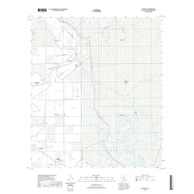
2018 Map of Catahoula
USGS Topo · Published 2018About this map
Catahoula sits at the edge of the immense Atchafalaya Basin Floodway, marking a distinct boundary where residential development meets the intricate wetland systems of Saint Martin Parish. The landscape is defined by the managed flow of water, with the Catahoula Levee Rd and W Levee Rd serving as vital infrastructure protecting local communities. The settlement pattern follows the high ground along these embankments, with local centers like Coteau Holmes and Bankers connected by rural routes such as the St Rita Hwy.
Find a feature on this map
50 named features on this map. Tap any name to fly to it.
Don’t see what you’re looking for? This feature index may not catch every label — zoom into the map to look around manually.
Map Details
Editions of this 2018 Catahoula Map
This is the sole edition of this map. No revisions or reprints were ever made.
Other maps of this area

1935 · Osca Bayou
USGS Topo · 1:62,500

1939 · St. Martinsville
USGS Topo · 1:62,500

1940 · Arnaudville
USGS Topo · 1:62,500

1941 · Loreauville
USGS Topo · 1:62,500

1953 · Cow Bayou
USGS Topo · 1:24,000

1954 · Loreauville
USGS Topo · 1:62,500

1954 · Baton Rouge
USGS Topo · 1:250,000

1955 · Osca Bayou
USGS Topo · 1:62,500

1956 · Baton Rouge
USGS Topo · 1:250,000

1957 · St. Martinville
USGS Topo · 1:62,500