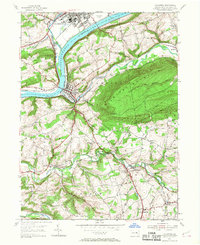
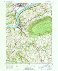
1955 Map of Catawissa
USGS Topo · Published 1968About this map
The Susquehanna River and its confluence with Fishing Creek anchor this mid-century look at Columbia County, Pennsylvania. The area's industrial and agricultural history is visible through the milling sites along Roaring Creek, such as Parrs Mill and Pensyls Mill, which relied on the local water power. The landscape is dominated by the steep rises of Catawissa Mountain and Montour Ridge, creating a narrow corridor for the Reading D L & W and other rail lines that defined the regional economy. Small communities like Rupert and Mainville are documented alongside numerous local institutions, including Old Quaker Ch, Our Lady of Mercy Ch, and McIntyre Sch. These scattered churches and rural schoolhouses reflect the distributed settlement patterns of the river valleys and mountain gaps before later modern consolidation changed the rural character of the region.
Find a feature on this map
45 named features on this map. Tap any name to fly to it.
Don’t see what you’re looking for? This feature index may not catch every label — zoom into the map to look around manually.
Map Details
Editions of this 1955 Catawissa Map
5 editions found
Other maps of this area

1889 · Catawissa
USGS Topo · 1:62,500

1892 · Catawissa
USGS Topo · 1:62,500

1892 · Shamokin
USGS Topo · 1:62,500

1893 · Shamokin
USGS Topo · 1:62,500

1894 · Catawissa
USGS Topo · 1:62,500

1894 · Bloomsburg
USGS Topo · 1:62,500

1935 · Hughesville
USGS Topo · 1:62,500

1943 · Shamokin
USGS Topo · 1:62,500

1947 · Bloomsburg
USGS Topo · 1:24,000

1947 · Ashland
USGS Topo · 1:24,000