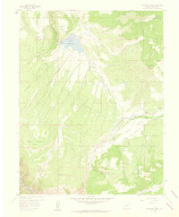
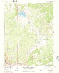
1957 Map of Cathedral Peak
USGS Topo · Published 1959About this map
Gunnison National Forest dominates this mid-century landscape in the Colorado high country, where the dramatic depths of the Black Canyon of the Gunnison River cut through the southwestern corner of the quadrangle. The map reveals an intricate network of water management essential for high-elevation ranching and agriculture, featuring the Cattlemans Ditch and Dyer Fork Ditch winding through Crystal Valley. Water storage is centered at the Gould Reservoir and Meek Reservoir, while Gates Camp serves as a small outpost of activity in this complex terrain. From the heights of Cathedral Peak to the broad expanse of Dead Horse Mesa, the topography is defined by sharp ridges like Poison Spring Ridge and deep drainages such as Iron Creek Canyon. The prevalence of jeep trails and named gulches like Buckhorn Gulch illustrates the frontier-style access and seasonal land use typical of the Western Slope during this era.
Find a feature on this map
28 named features on this map. Tap any name to fly to it.
Don’t see what you’re looking for? This feature index may not catch every label — zoom into the map to look around manually.
Map Details
Editions of this 1957 Cathedral Peak Map
7 editions found
Other maps of this area

1908 · Uncompahgre
USGS Topo · 1:125,000

1909 · Montrose
USGS Topo · 1:125,000

1911 · Uncompahgre
USGS Topo · 1:125,000

1911 · Montrose
USGS Topo · 1:125,000

1956 · Curecanti Needle
USGS Topo · 1:24,000

1956 · Cimarron
USGS Topo · 1:24,000

1956 · Montrose
USGS Topo · 1:250,000

1957 · Cathedral Peak
USGS Topo · 1:24,000

1957 · X Lazy F Ranch
USGS Topo · 1:24,000

1957 · Cerro Summit
USGS Topo · 1:24,000