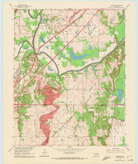
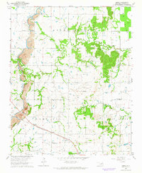
1963 Map of Catoosa
USGS Topo · Published 1972About this map
Catoosa sits at a critical junction of Oklahoma transportation and geography in the early 1960s, defined by the winding course of the Verdigris River and the newly established Will Rogers Toll Road Turnpike. The landscape is a mix of fertile river bottoms like Rascal Flat and heavy industrial activity, most notably the massive Strip Mine that dominates the central terrain. Smaller settlements such as Verdigris are scattered among a network of local landmarks, including Yonkipin Lake and Big Lake. Genealogists will find significant value in the documentation of local burial grounds like Wofford Cem, River Hill Cem, and Crutchfield Cem, alongside community centers like the Timber Ridge Ch. The map also captures the path of the St Louis - San Francisco railroad and numerous extractive sites, including several Gas Wells and Oil Wells that fueled the local economy during this era.
Find a feature on this map
30 named features on this map. Tap any name to fly to it.
Don’t see what you’re looking for? This feature index may not catch every label — zoom into the map to look around manually.
Map Details
Editions of this 1963 Catoosa Map
4 editions found
Other maps of this area

1901 · Claremore
USGS Topo · 1:125,000

1914 · Claremore
USGS Topo · 1:125,000

1916 · Claremore
USGS Topo · 1:125,000

1954 · Tulsa
USGS Topo · 1:250,000

1955 · Mingo
USGS Topo · 1:24,000

1955 · Broken Arrow
USGS Topo · 1:24,000

1956 · Collinsville
USGS Topo · 1:24,000

1958 · Tulsa
USGS Topo · 1:250,000

1963 · Tulsa
USGS Topo · 1:250,000
1963 · Oneta
USGS Topo · 1:24,000