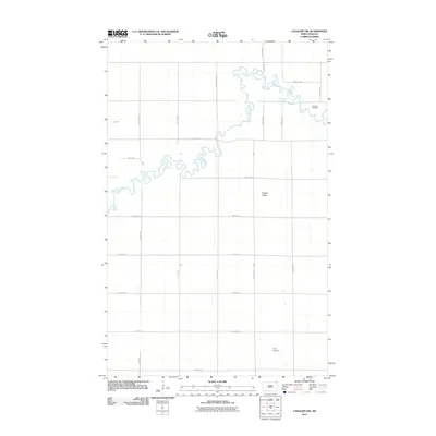
2011 Map of Cavalier NW
USGS Topo · Published 2011About this map
The Pembina River meanders sharply across this northern prairie landscape, creating a complex series of oxbows and bends as it flows toward the Red River Valley. This 2011 survey of Pembina County reflects a region defined by its precise section-line road grid and sparsely populated agricultural tracts. Small but significant markers of local heritage are preserved in the form of the Lutheran Cemetery in the northeast and Tyner Cemetery further south, providing fixed points for genealogical research in an otherwise open terrain. Elevation changes are subtle, with Horgan Ridge serving as a primary topographic feature overlooking the river valley. The infrastructure is dominated by rural corridors such as County Rd 1, which anchors the southern edge of the quadrangle and facilitates movement between the isolated farmsteads and surrounding townships.
Find a feature on this map
21 named features on this map. Tap any name to fly to it.
Don’t see what you’re looking for? This feature index may not catch every label — zoom into the map to look around manually.
Map Details
Editions of this 2011 Cavalier NW Map
This is the sole edition of this map. No revisions or reprints were ever made.
Other maps of this area

1918 · Walhalla
USGS Topo · 1:62,500

1939 · Cavalier
USGS Topo · 1:62,500

1941 · Cavalier
USGS Topo · 1:62,500

1943 · Walhalla
USGS Topo · 1:62,500

1952 · Thief River Falls
USGS Topo · 1:250,000

1956 · Thief River Falls
USGS Topo · 1:250,000

1957 · Thief River Falls
USGS Topo · 1:250,000

1964 · Hallson
USGS Topo · 1:24,000

1964 · Leroy
USGS Topo · 1:24,000

1964 · Neche
USGS Topo · 1:24,000