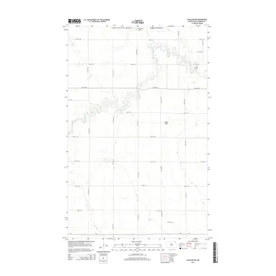
2014 Map of Cavalier NW
USGS Topo · Published 2014About this map
The Pembina River snakes across this northern corner of Pembina County, its deep, meandering valley cutting through the otherwise geometric grid of the Red River Valley’s prairie. This landscape, located just south of the United States and Canada border, is defined by large-scale agricultural blocks and the topographical rise of Horgan Ridge. The drainage of Hyde Park Coulee in the north and the river's winding course provide the only breaks in a remarkably flat terrain dominated by section lines and rural roadways. Genealogical value is preserved at the Lutheran Cem and the southern Tyner Cem, which serve as quiet markers of the scattered settlements that once supported the region's farming community. This survey provides a precise view of the local road network, including Cr-1 and Co 1, as they existed in the early twenty-first century.
Find a feature on this map
24 named features on this map. Tap any name to fly to it.
Don’t see what you’re looking for? This feature index may not catch every label — zoom into the map to look around manually.
Map Details
Editions of this 2014 Cavalier NW Map
This is the sole edition of this map. No revisions or reprints were ever made.
Other maps of this area

1918 · Walhalla
USGS Topo · 1:62,500

1939 · Cavalier
USGS Topo · 1:62,500

1941 · Cavalier
USGS Topo · 1:62,500

1943 · Walhalla
USGS Topo · 1:62,500

1952 · Thief River Falls
USGS Topo · 1:250,000

1956 · Thief River Falls
USGS Topo · 1:250,000

1957 · Thief River Falls
USGS Topo · 1:250,000

1964 · Hallson
USGS Topo · 1:24,000

1964 · Leroy
USGS Topo · 1:24,000

1964 · Neche
USGS Topo · 1:24,000