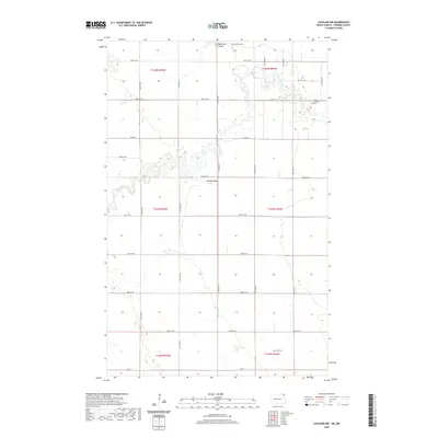
2020 Map of Cavalier NW
USGS Topo · Published 2020About this map
The Pembina River carves a winding path across this section of northeastern North Dakota, defining the agricultural landscape with its deep oxbows and riparian curves. Elevated above the river flats, Horgan Ridge provides a distinct topographic break in the otherwise steady grid of township roads. This area of Pembina County preserves its rural character through scattered landmarks that anchor the community's history, such as Hyde Park Cem in the north and the Christ Lutheran Cem further east. Along the northern edge, Hyde Park Coulee feeds into the drainage system, illustrating the subtle watercourses that dictate the placement of farmsteads and transport routes. In the southern reaches, Tyner Cem remains a quiet marker of the region's long-established settlement patterns.
Find a feature on this map
28 named features on this map. Tap any name to fly to it.
Don’t see what you’re looking for? This feature index may not catch every label — zoom into the map to look around manually.
Map Details
Editions of this 2020 Cavalier NW Map
This is the sole edition of this map. No revisions or reprints were ever made.
Other maps of this area

1918 · Walhalla
USGS Topo · 1:62,500

1939 · Cavalier
USGS Topo · 1:62,500

1941 · Cavalier
USGS Topo · 1:62,500

1943 · Walhalla
USGS Topo · 1:62,500

1952 · Thief River Falls
USGS Topo · 1:250,000

1956 · Thief River Falls
USGS Topo · 1:250,000

1957 · Thief River Falls
USGS Topo · 1:250,000

1964 · Hallson
USGS Topo · 1:24,000

1964 · Leroy
USGS Topo · 1:24,000

1964 · Neche
USGS Topo · 1:24,000