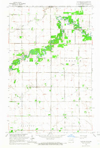
1964 Map of Cavalier NW
USGS Topo · Published 1966About this map
The meandering Pembina River carves a deep green corridor through the flat agricultural lands of Pembina County in this mid-1960s study. The landscape is characterized by a precise grid of section lines and unimproved dirt roads, reflecting the systematic settlement of the Red River Valley. Along the river’s erratic bends, designated areas like St Joseph and Felson mark specific recreational or land-use zones. Cultural life for the rural population centers on landmarks such as Park Center Ch and family-linked burial grounds including Hyde Park Cem and Tyner Cem. To the north, the topographic relief of Horgan Ridge and the drainage of Park Coulee provide the only major breaks in the prairie horizon, illustrating the transition of the northern plains landscape just south of the Canadian border.
Find a feature on this map
12 named features on this map. Tap any name to fly to it.
Don’t see what you’re looking for? This feature index may not catch every label — zoom into the map to look around manually.
Map Details
Editions of this 1964 Cavalier NW Map
This is the sole edition of this map. No revisions or reprints were ever made.
Other maps of this area

1918 · Walhalla
USGS Topo · 1:62,500

1939 · Cavalier
USGS Topo · 1:62,500

1941 · Cavalier
USGS Topo · 1:62,500

1943 · Walhalla
USGS Topo · 1:62,500

1952 · Thief River Falls
USGS Topo · 1:250,000

1956 · Thief River Falls
USGS Topo · 1:250,000

1957 · Thief River Falls
USGS Topo · 1:250,000

1964 · Hallson
USGS Topo · 1:24,000

1964 · Leroy
USGS Topo · 1:24,000

1964 · Neche
USGS Topo · 1:24,000