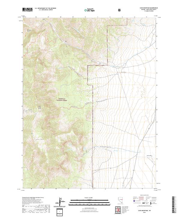
2021 Map of Cave Mountain
USGS Topo · Published 2021About this map
Cave Mtn dominates the high-altitude landscape of the Schell Creek Range in this modern topographic study of eastern Nevada. The area is defined by the steep transition from the mountain peaks of the Humboldt National Forest down to the flat expanse of Spring Valley to the east. Water sources are critical identifiers in this arid environment, with drainage networks like Cleve Creek and its North Fork carving through the canyons. Notable high-country landmarks include the Kolcheck Basin and several remote water points such as Indian Springs, Cottonwood Spring, and Bastian Spring. A network of specialized trails, including the Cottonwood Spring Trl and Bastian Basin Trl, provides the primary access through the wooded terrain, reflecting the area's ongoing use for recreation and forest management. This map documents the complex topography of the Great Basin, where isolated springs and creek beds dictate the routes of travel and historical land use patterns.
Find a feature on this map
31 named features on this map. Tap any name to fly to it.
Don’t see what you’re looking for? This feature index may not catch every label — zoom into the map to look around manually.
Map Details
Editions of this 2021 Cave Mountain Map
This is the sole edition of this map. No revisions or reprints were ever made.
Other maps of this area

1952 · Ely
USGS Topo · 1:125,000

1956 · Ely
USGS Topo · 1:250,000

1959 · Ely
USGS Topo · 1:250,000

1959 · Sacramento Pass
USGS Topo · 1:62,500

1959 · Connors Pass
USGS Topo · 1:62,500

1959 · Schell Peaks
USGS Topo · 1:62,500

1963 · Ely
USGS Topo · 1:250,000
1981 · Connors Pass
USGS Topo · 1:24,000
1981 · Majors Place
USGS Topo · 1:24,000
1981 · South Schell Peak
USGS Topo · 1:24,000