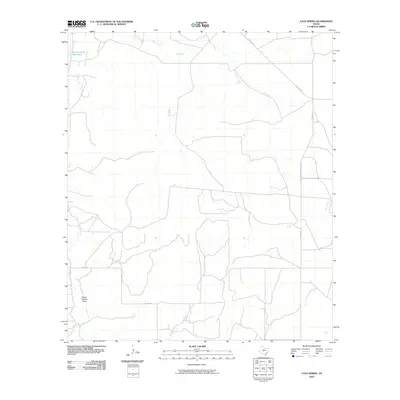
2010 Map of Cave Spring
USGS Topo · Published 2010About this map
Panther Bluff stands as a prominent landmark in this corner of Tom Green County, where the landscape is defined by its vital water sources and historic ranching routes. The eponymous Cave Spring and the Panther Bluff Waterhole anchor the northern reaches of the quadrangle, serving as critical points in an arid Texas environment. These features are linked by the distinctively named Toe Nail Trl, reflecting the unique local nomenclature of the region's historical trails. In the southwest, the South Concho River and South Concho Draw highlight the drainage patterns that have shaped land use for generations. The map reveals a network of rural connections like Schleicher County Road 320 and Harkey Ln, illustrating the transition from natural waterways to modern county infrastructure across the Dry Creek basin.
Find a feature on this map
11 named features on this map. Tap any name to fly to it.
Don’t see what you’re looking for? This feature index may not catch every label — zoom into the map to look around manually.
Map Details
Editions of this 2010 Cave Spring Map
This is the sole edition of this map. No revisions or reprints were ever made.
Other maps of this area

1892 · San Angelo
USGS Topo · 1:125,000

1893 · Fort McKavett
USGS Topo · 1:125,000

1895 · Sherwood
USGS Topo · 1:125,000

1954 · Sonora
USGS Topo · 1:250,000

1954 · San Angelo
USGS Topo · 1:250,000

1958 · Sonora
USGS Topo · 1:250,000

1958 · San Angelo
USGS Topo · 1:250,000

1963 · Adams
USGS Topo · 1:24,000

1963 · Adams NW
USGS Topo · 1:24,000
1964 · Eldorado NE
USGS Topo · 1:24,000