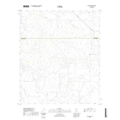
2019 Map of Cave Spring
USGS Topo · Published 2019About this map
Cave Spring serves as a focal point in this portion of West Texas, where the landscape is defined by the intermittent drainages that feed the S Concho River. The map captures the dividing line between Tom Green Co and Schleicher Co, showing a region largely organized around ranching infrastructure and rural access roads. Water management and natural catchment areas are central to the local geography, evidenced by features like the Panther Bluff Waterhole and the sprawling South Concho Draw. Surface water is scarce, with Dry Cr and Bois D'Arc Draw cutting through the terrain, illustrating the importance of named springs and waterholes to the area's historical land use and navigation. The road network, including Ranch Rd 2084 and various family-named routes such as Butts Rd and Stansbury Rd, follows the contours of the draws and ridges.
Find a feature on this map
16 named features on this map. Tap any name to fly to it.
Don’t see what you’re looking for? This feature index may not catch every label — zoom into the map to look around manually.
Map Details
Editions of this 2019 Cave Spring Map
This is the sole edition of this map. No revisions or reprints were ever made.
Other maps of this area

1892 · San Angelo
USGS Topo · 1:125,000

1893 · Fort McKavett
USGS Topo · 1:125,000

1895 · Sherwood
USGS Topo · 1:125,000

1954 · Sonora
USGS Topo · 1:250,000

1954 · San Angelo
USGS Topo · 1:250,000

1958 · Sonora
USGS Topo · 1:250,000

1958 · San Angelo
USGS Topo · 1:250,000

1963 · Adams
USGS Topo · 1:24,000

1963 · Adams NW
USGS Topo · 1:24,000
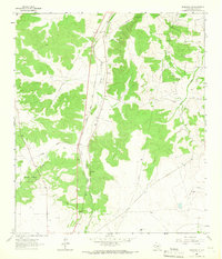
1964 · Eldorado NE
USGS Topo · 1:24,000