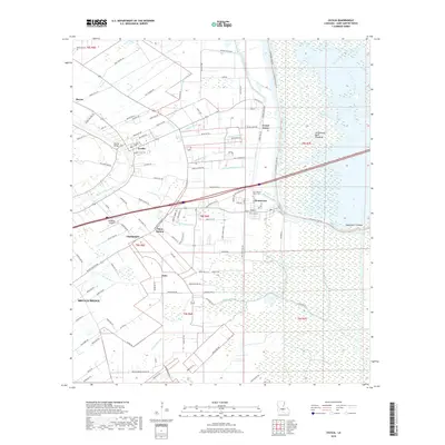
2018 Map of Cecilia
USGS Topo · Published 2018About this map
The Bayou Teche winds through this landscape of Acadiana, separating the established settlement of Cecilia from the intricate network of drainage canals and the expansive Atchafalaya Basin Floodway to the east. This 2018 survey reveals a terrain defined by water management and low-lying geography, featuring several named man-made waterways like the Dupuis Canal, Chenierre Canal, and Ledet Canal. These canals represent the historical effort to drain the fertile but flood-prone basin for agriculture and habitation.
Find a feature on this map
115 named features on this map. Tap any name to fly to it.
Don’t see what you’re looking for? This feature index may not catch every label — zoom into the map to look around manually.
Map Details
Editions of this 2018 Cecilia Map
This is the sole edition of this map. No revisions or reprints were ever made.
Other maps of this area

1935 · Osca Bayou
USGS Topo · 1:62,500

1939 · St. Martinsville
USGS Topo · 1:62,500

1940 · Arnaudville
USGS Topo · 1:62,500

1941 · Loreauville
USGS Topo · 1:62,500

1954 · Loreauville
USGS Topo · 1:62,500

1954 · Baton Rouge
USGS Topo · 1:250,000

1955 · Osca Bayou
USGS Topo · 1:62,500

1956 · Baton Rouge
USGS Topo · 1:250,000

1957 · St. Martinville
USGS Topo · 1:62,500
1959 · Osca Bayou
USGS Topo · 1:62,500