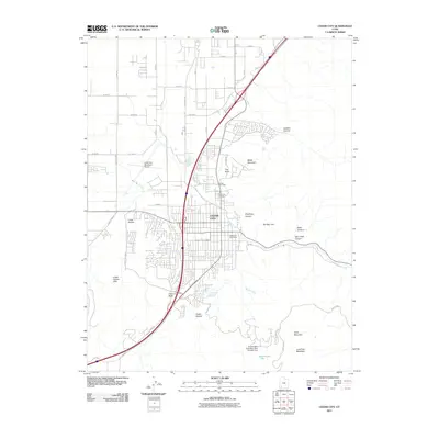
2011 Map of Cedar City
USGS Topo · Published 2011About this map
Cedar City's expansion into the surrounding canyons and high desert terrain is evident in this early 21st-century record. The map documents a complex landscape where civic infrastructure like the Cedar City Municipal Airport and the Cedar City Post Office meet prominent geological landmarks. Drainage patterns are defined by Coal Creek and Squaw Creek, with water management highlighted by the Greens Lake Retarding Dam Number Four near Green Lake.
Find a feature on this map
30 named features on this map. Tap any name to fly to it.
Don’t see what you’re looking for? This feature index may not catch every label — zoom into the map to look around manually.
Map Details
Editions of this 2011 Cedar City Map
This is the sole edition of this map. No revisions or reprints were ever made.
Other maps of this area

1885 · St. George
USGS Topo · 1:250,000

1886 · Kanab
USGS Topo · 1:250,000

1891 · St. George
USGS Topo · 1:250,000

1949 · Cedar City NW
USGS Topo · 1:24,000

1950 · Cedar City NW
USGS Topo · 1:24,000

1950 · Kanarraville
USGS Topo · 1:24,000

1950 · Enoch
USGS Topo · 1:24,000

1950 · Cedar City
USGS Topo · 1:24,000

1950 · Enoch
USGS Topo · 1:62,500

1950 · Cedar City
USGS Topo · 1:62,500